The Trek
- Location : Sekolah Kebangsaan Pos Gedong - Bidor
- Usually it takes 5~6 hours+ one way
- Distance : 10.5 KM+ one way
Getting there
- Use Google Map reach for Sekolah Kebangsaan Pos Gedong
- Car Park (4.170634, 101.376944)
Facilities and Fees
- No Internet Connection
- Toilet and Bathroom : School
- Parking : RM 10.00 School
- Guide : Effective from 1/6/2023
- Permit : Yes
- JPSM Permit Information
- JPSM Contact Information
GPX in Google Map
Gunung Bah Gading Trail Map
GPX Download Link
Download
Exploring Gunung Bah Gading
April, 22 2023
Gunung Bah Gading located in Pos Gedong near by Bidor with the height of 1640 meter a.s.l. This mountain was in my hiking list for long time and I did my first attempt on 2019.
I have been to this Orang Asli Settlement several times on 2019, 2022 and 2023 to do some donation, one of our group member came one day before to donate stationery and toys to all the children.
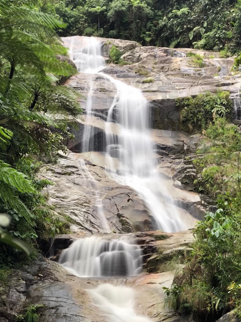
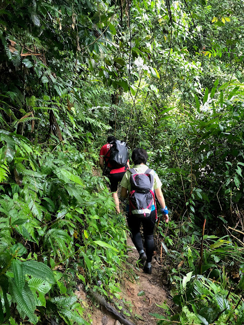
The weather conditions and water level is the most unpredictable criteria for the hike, you may cross multiple times (six major crossing) along Sungai Gedong upstream till Tigok Waterfall campsite with the distance of 7.0 KM. Full of leeches (Tiger leech) are waiting for you and trail condition are dangerous, slippery and less marking.
All the way ascent from Camp Tigok to Camp Permatang (No signboard) - LWP - False Peak. You can see the Bah Gading summit is on another peak.
Just to this opportunity to share a bit of my experience on this mountain
1st Attempt 2019 May 03 to Tigok Waterfall
Six of us started our hike at 9:00 a.m. finding the trail and crossing the river smoothly till Tigok Waterfall within 2 hours 15 minutes. We decided not to attempt the summit as timing is not allowed us to do that. We spent an hour plus in the waterfall and back to trail head.
While we trying to crossed the last 3 rivers one of the team member suddenly saw the "Kepala Air" was on the way. We made the fast decision to stepped up the highest point of the rock and stuck there for 2 hours plus to monitored the water level and current.
Luckily we managed to crossed the river and back to the trail head before dark.
2nd Attempt 2023 April 22 to Bah Gading
This hike joined with a big group with many experience hikers. As usual I still did my homework by downloading multiple sources of GPX log, did my timing estimation, studied the landmarks, trail profile etc. for my own reference.
The trail is confusing especially on river crossing in the dark, ensure you go with a team who knows the trail well and do not leave any member hike on their own / group while existing from Camp Tigok if they did not recognised the trail well.
0530 Start from Pos Godeng
0544 River 1
0554 River 2
0619 River 3 (Most dangerous area)
0630 Wrong way while crossing the river
0655 Back to correct trail
0701 Regroup
0708 Continue
0714 River 4
0742 River 5
0809 River 6
0824 Camp Tigok
0848 Continue after rest
0917 Small Campsite
1007 Camp Permatang
1034 Continue after regroup with my team member
1047 LWP
1133 Summit
1232 Descent
1302 LWP
1313 Camp Permatang
1323 Continue after regroup
1352 Small Campsite
1425 Camp Tigok
1540 Continue after waiting all members regroup
1615 Leading 2 members out, 3 at the back leading by another team member
1800 Trail head
 |
| River Crossing |
 |
| Trail after Camp Tigok |
 |
| Camp Permatang |
 |
| Gunung Bah Gading Trail Profile |
2019 May 03 Photos
 |
| River Crossing |
 |
| Tigok Waterfall |
 |
| River 03 crossing after kepala air |


Thank you for still updating in 2023. Hope you can start posting on tiktok
ReplyDeleteYes! Came here to say the same thing. Following you and your wife long time already. Hope to see both of u on tik tok or IG
ReplyDelete