The Trek
· Height : Camp Baha 463 meter, Gunung Baha
1,450 meter, Gunung Ayam 1,550 meter, Gunung Stong 1422 meter
· Location : Jelawang (Kelantan)
· Usually it takes 3D2N
· Distance : Car Park to Camp Baha 3.4 KM, Camp Baha –
Gunung Baha – Gunung Ayam – Gunung Stong – Camp Baha 14.4 KM, Camp Baha – Car Park
2.1 KM
Getting there
· From Lebuhraya Utara-Selatan/E2
· MRR2/Route 28
· Exit Bentong Toll and follow Lebuhraya Kuala Lumpur – Gua Musang/E8
to Gua Musang
· Follow Jalan Jelawang-Gua Musang/D29 to Dabong
· Turn left to Gunong Stong State Park Resort (GSSP)
Facilities and Fees
· Toilet and Bathroom : Yes
· Parking and Camping Fee – RM 10.00
· Permit and Guide : RM 73 / pax (Apply in advance)
GPX in Google Map
Gunung Baha, Ayam, Stong Trail Map
GPX Download Link
Exploring Gunung Baha, Gunung Ayam, Gunung
Stong
October, 01~03 2016
Mount Baha, Ayam and Stong located within Gunung Stong State
Park, in Jelawang Kelantan manage by Gunong Stong State Park Resort (GSSP).
Permit and guide are compulsory before hike.
There are many activities and packages available such as:
·
Caving near Dabong (Gua Ikan, Gua Kelap,
Gua Pagar, Gua Keris)
·
Jelawang/Stong Waterfall + other
waterfalls and water sport activates
·
Camping in Camp Baha
·
Gunung Stong alone
·
Gunung Baha, Ayam, Stong
·
And others
We decided a 3D2N exploring 3 in 1 caving and hiking trip:
·
Day 1:
ü
Caving (Gua Kelap, Gua Pagar, Gua
Keris) – approx. 2 hours
ü
Hiking to Camp Baha – approx. 1 hour
15 minutes
·
Day 2:
ü
Day hike Gunung Baha, Gunung Ayam, Gunung
Stong – approx.. 10~12 hours
·
Day 3:
ü
Offered us to other waterfall but we
decided to go back earlier
ü
Camp Baha to Gunung Stong State Park
Resort (GSSP) – approx. 45 minutes
We spent half day for caving activity in day 1 before hiking
to camp Baha. Backpack with heavy load
for the 2 hours’ journey was really worth it as we could enjoyed our party throughout
the whole night. The next we proceed with a day hike for Gunung Baha, Ayam and Stong total
distance of approx. 14.4 KM from/to Camp Baha with less than 10 hours.
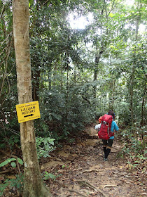
Day 1: Gunong Stong State Park Resort (GSSP) to Camp Baha
A total distance of approx. 3.4 KM from GSSP to Camp baha
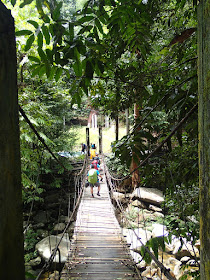
with all the way up. By through resorts, waterfall view and all the way to Camp
Baha. A big campsite with nice view and waterfall.
1331 Car Park
1346 Waterfall View
1354 Continue
1410 Rest Point
1421 Continue
1445 Junction
1448 Camp Baha
Day 2: Day hike Gunung Baha, Ayam, Stong
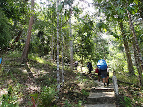
Stage 1: Camp Baha – Sungai Rantai – Camp Balak – Y Junciton
- River crossing – Gunung Baha
·
All the way ascent of approx. 3 ½ hours
journey with two water source in between
·
Y Junction after Camp Balak, turn
right to Gunung Baha, Ayam and turn left to Gunung Stong
Stage 2: Gunung Baha– Y Junction - Water Point – Gunung Ayam
·
Descent to Y junction for Stong and
Ayam and all the way up with Bonsai view to Gunung Ayam. The journey is approx..30 minutes
from Baha summit to Ayam Summit
·
2 minutes’ walk to water source after
the Y junction
Stage 3: Gunung Ayam –
Y Junction – Gunung Stong
·
Descent to Y junction and turn right
to Gunung Stong
·
Continue with a “V” trail (Down and
Up) before reaching Gunung Stong
·
Total journey of 1 hour plus from
Ayam to Stong
Stage 4: Gunung Stong – Boulder – Boulder with water source –
Y Junction – Camp Balak – Sungai Rantai – Camp Baha
·
All the way down with steep step
from Stong summit to Boulder
·
Total journey of 2 hours with two
water source in between
0813 Start hiking from Camp Baha
0830 Sungai Rantai
0837 Continue
0859 Camp Balak
0907 Continue
0923 River
0948 Continue
1012 Rest Point 01
1024 Continue
1053 Rest Point 02
1101 Continue
1140 Reached Gunung Baha Summit
1158 Descent from Gunung Baha Summit
1210 Water Source
1218 Continue
1231 Reached Gunung Ayam Summit
1330 Descent from Gunung Ayam Summit
1343 Water Source
1357 Continue
1418 Rest Point 03
1435 Continue
1450 Rest Point 04
1458 Continue
1505 Reached Gunung Stong Summit
1614 Descent from Gunung Stong Summit
1636 Rest Point (Boulder)
1646 Continue
1705 Boulder with Water Source
1722 Continue
1727 Camp Balak
1738 Sungai Rantai
1744 Continue
1757 Reached Camp Baha
Day 3: Camp Baha - Gunong Stong State Park Resort (GSSP)
1111 Descent from Camp Baha
1130 Rest point
1134 Continue with alternative route
1156 Reached Gunong Stong State Park Resort(GSSP)
 |
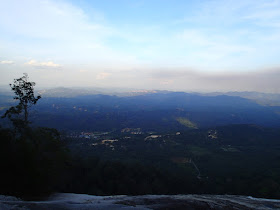
| Gunung Baha, Ayam, Stong view |
 |
| Jelawang/Stong Waterfall View |
 |
| Journey Start from Gunong Stong State Park Resort (GSSP) |
 |
| Alternative route |
 |
| Nice swimming pool |
 |
| Rest Point |
 |
| Camp Baha |
 |
| Water Sport |
 |
| Day 2 : Dayhike Gunung Baha, Ayam, Stong |
 |
| Jelawang Jungle Trekking |
 |
| Sungai Rantai |
 |
| River Crossing |
 |
| Gunung Baha Summit |
 |
| Water Source |
 |
| Bonsai View |
 |
| Gunung Ayam Summit |
 |
| Boulder |
 |
| Boulder with water source |
 |
| Camp Balak |
 |
| Sungai Rantai |
 |
| Reached back to Camp Baha |
 |
| Descent to Resort on day 3 |
 |
| Via alternative route |
 |
| Gunung Baha, Ayam, Stong Trail Map |
 |
| Gunung Baha, Ayam, Stong Trail Profile |







Hello sir, what map application do you use or download in computer to analyse mountain topography and record your trail journey.
ReplyDeleteThanks for sharing.
Very appreciate.
Hi,
DeleteI am using BaseCamp software.
Hi sir,
ReplyDeleteEnjoyed reading your blog and an avid follower. Can you suggest which mountain that can be done in one day (approximately 12 hours) and does not require permit/permit on site. I just want to hike spend sometime on the top and get down.
Thanks
Johnson
Hi Johnson,
DeleteHonestly, not much choice as what I know that for those dayhike of 12 hours without permit.
1. Gunung Rajah via KKB (I haven't hiked before)
2. Gunung Rajah via Bentong
2. Gunung semangkuk in Fraser Hill (I haven't hiked before)
3. Gunung Chabang
4. Gunung Irau-Yellow-Pass
5. Gunung Yong Belar (2 routes)
6. Gunung Batu Putih
7. Reverse Trans Nuang
Try to avoid mountain with river crossing especially this raining session. Just had my second experience overnight in the jungle without gear because of not able to cross the river last weekend.
Enjoy.
Permit is required for the above reserved forest, you may confirm this at the Forestry dept websites or take at own risk. There will be no SAR on missing or lost hiker if no police report/ permit applied before hike. Advise to engage guide.
DeleteHello Mchiker, can you give me the guider contact number? Thank You.
ReplyDeleteYou may contact En. Wan Mahadi (+601110666045) or email ykkelantan@gmail.com
DeleteGunung Stong State Park Resort.
Can we hike without guider? I mean, just use the gps only.
ReplyDeleteCan we hike without guider? I mean, just use the gps only.
ReplyDeleteHi,
ReplyDeleteYou got to apply permit and guide...manage by Gunung Stong Sate Park Resort
Hey there, no one reply on the contact and I can't seems to reach any others contact available online as well.
ReplyDelete2.
Hi Mchiker, could you please share me a downloadable version of the trail with POIs? Thanks in advance!
ReplyDeleteHi Eddie,
DeleteWhat's your email address? You could email to mailbox.mchiker@gmail.com
hello boss... nak minta jasa baik bos. share gpx loc
ReplyDeleteLasahironworkz@gmail.com
hello boss... nak minta jasa baik bos. share gpx loc
ReplyDeleteLasahironworkz@gmail.com
Just emailed to you
Deletenice one sir.
ReplyDeleteboss, nice write up and i always read your blog. can you share me the gpx file at sanorhizamsadili@gmail.com. Thanks
ReplyDeletehi, really like your blogs very details and informative. can you share the maps email to antz2205@gmail.com thank you so much!
ReplyDeleteSorry for the late reply. I did not receive any email notification from the blog recently and not away that you have left a message.
DeleteHi , if you dont mind to share yr GPX data for above hike
ReplyDeleteThanks
neoaikben@gmail.com
Hi Bro, can share me your GPX of this hike.. thank you so much email : williamwoo87@gmail.com
ReplyDelete