The Trek
- Height : 2011 feet ( 613 meter) N2.784877, E101.847011
- Location : Labu (Negeri Sembilan)
- Usually it takes 1.5 ~ 2.5 hours day trip
- Distance : about 3.8 KM
Getting there
- From North-South highway towards Seremban, take exit Bandar Ainsdale
- Turn right to Jalan Labu towards Labu
- Turn right to KTM Labu station
- Continue straight and turn left just after the KTM station (signboard 4.KM to Kg. Tekir)
- Continue straight pass through the tunner, go straight and follow the right curve turn with tar road to Kg. Tekir
- Continue about 1.5 KM until you see a car park area on your left and starting trail head as picture below. (2.765403, 101.843942)
Facilities and Fees
- Toilet and Bathroom : R&R Seremban
- Parking : No
- Guide : No
- Permit Fee : RM 5.00 (Apply in advance)
- JPSM Permit Information
- JPSM Contact Information
GPX in Google Map
Bukit Galla via Kampung Tekir Trail Map
GPX Download Link
Download
Exploring Bukit Galla via Kampung Tekir Mentera
March, 11 2017
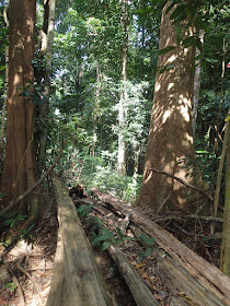
Once again revisit Batu Pecah but this round try to explore the new trail via Kampung Tekir Mentera and attempt to Bukit Galla Peak. The trail head just beside the main road without any signboard (Refer to the picture below). The parking area could allocate few cars. Starting trail with rubber tree plantation and ascent slowing. Among the way with ribbon marking and signboard. Credits to the previous team whom provide the trail direction. That are many small path in between and you got to follow the ribbon marking carefully.
After an hour plus we reached the "Y" junction to unknown peak and plantation trail. Just continue few minutes will lead you to Batu Pecah.
The trail head to Bukit Galla just behind Batu Pecah with a clear path and ribbon marking. Continue 25~30 minutes and finally reached Bukit Galla Peak.
After an hour plus we reached the "Y" junction to unknown peak and plantation trail. Just continue few minutes will lead you to Batu Pecah.
The trail head to Bukit Galla just behind Batu Pecah with a clear path and ribbon marking. Continue 25~30 minutes and finally reached Bukit Galla Peak.
There are two trails could lead you to Batu Pecah and Bukit Galla:-
- Via Kampung Tekir Mentera
Place of Interest:-
- Unknown Peak - Explored on 18th Feb
- Batu Pecah - Explored on 26th Feb
- Bukit Galla Peak - Explored on 11th March
Stage 1: Car Park - Batu Pecah
09:27 Car Park
10:45 Junction "Y" to Plantation trail
10:48 Batu Pecah
Stage 2: Batu Pecah - Bukit Galla Peak
11:40 Start
12:06 Bukit Galla Peak
Descent
12:40 Start
13:03 Reached Batu Pecah
13:37 Continue
14:16 Car Park
 |
| Key landmark |
 |
| Trail Head (Car Park Area) |
 |
| Trail Head (You could view this from main road) |
 |
| Credit to the team provide marking and signboard |
 |
| Once again....Batu Pecah |
 |
| Campsite after few minutes walked from Batu Pecah |
 |
| Bukit Galla Peak |
 |
| Back to Batu Pecah |
 |
| Bukit Galla Trail Head via Kampung Tekir Mentera |
 |
| Bukit Galla Trail Map (Via Kampung Tekir Mentera) |
 |
| Bukit Galla Trail Profile (Via Kampung Tekir Mentera) |
 |
| Bukit Galla Trail Map (Plantation and Kampung Tekir Mentera Trail) |


Hi. Can i know from where i should get the permit? Mail me at tramanan8994@gmail.com. Tq.
ReplyDeleteHi Ram,
DeleteNo permit is require...but unfortunately, trail from Kampung Tekir Mentera is no longer access. Know that they don't allow to access the trail anymore.
Ribbon marking has been removed from on "T" junction to Bukit Pecah, whether that is ribbon marking from starting point to "T" junction or not...I'm not too sure.
Hi mcHiker, now can't access the trail from Kampung Tekir Mentera anymore?
ReplyDeleteThe last round I went on Nov 2018, via Kampung Tekir trail was no longer access.
DeleteHi Alex, i saw from https://www.wikiloc.com/hiking-trails/kampung-tekir-mentera-b-galla-53834523, seem like they start from Kampung Tekir trail? on 2 Aug 2020
DeleteHi Alex, You have done both trail from Kampung Tekir Mentera and Plantation... which route is more challange / hard ?
DeleteCan't access via Kampung Tekir anymore...Challange trail from Plantation.
Delete