The Trek
- Height : 1364 feet (416 meter)
- Location : Serting, Negeri Sembilan
- Usually it takes 45 minutes ~ 1 hours plus
Getting there
- Using Waze App search for Kampung Serting Hilir (2.815930, 102.358980)
Facilities and Fees
- Toilet and Bathroom : No
- Parking : Roadside
- Guide Fee : No
- Permit Fee : No
GPX in Google Map
Exploring Bukit Penarikan
December, 01 2019
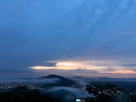
Bukit Penarikan @ Bukit Serting with the height of 416 meter a.s.l. located in Kampung Serting near by Bahau town. Easy pace with 45 minutes hiked to the peak early in the morning with magnificent scene of cloud sea view in surrounding area.
As far as I know, there are two paths could lead you to the peak. The easiest route from the main road junction turned into the housing area would lead you into the palm oil estate till the end with the gate. Park your car nearby and starting point just after the gate. All the way follow the main road until the left junction before going down hill. From the left junction till the peak would take you another 10 minutes.
 |
| Last section to peak |
 |
| Peak |
 |
| Descent from peak |
 |
| Left junction to peak...continue straight is downhill |
 |
| Key landmark of starting point |
 |
| Starting Point after this gate |
 |
Bukit Penarikan Trail Map
|
 |
| Bukit Penaritkan Trail Map with Satellite View |
 |
Bukit Penarikan Trail Profile
|


Do we need to pay any fees to enter this Treck?
ReplyDeleteDo you pay any guider?
No fees required.
DeleteNo guide needed if you study well the trail info...especially in Satellite view
PD Tanjung Tuan ?
ReplyDelete