The Trek
- Height : -
- Location : Behind Rimbun Irama S2 Height Seremban 2
- Usually it takes 1.5~2 hours (Route trip to Kampung Sebir)
- Distance : about 6.7 KM (Route trip to Kampung Sebir)
Getting there
- Using Waze App search for Rimbun Irama S2 (2.713960, 101.886140)
Facilities and Fees
- Toilet and Bathroom : -
- Parking Fee : -
- Entrance Fee : -
- Guide Fee : -
- Permit Fee : -
GPX in Google Map
GPX Download Link
Exploring Seremban Green Lake
August, 08 2020
I used to passed through this area almost everyday (exit from Bandar Ainsdale Toll) and saw lot of hikers/ hashers parked their car nearby Rimbu Irama. Checked with my uncle and confirmed that there are few trails which could:-
1. Loop back to Rimbun Irama area
2. Exit to Mantua area
3. Exit to Suriaman area
4. Exit to Kampung Sebir area
The starting point is from the hill top behind Rimbun Irama, you could either access from the tar road or trek up to the round about and continue hike till the jungle trail. Keep follow the main trail about 10 minutes will lead you to the first view point.
Any sub trail on the right hand side would either lead you back to Rimbun Irama area or Mantua area. I just continue followed the main trail for another 30 minutes to a big open area with View Point 2 and exit to Kampung Sebir.
0720 Start from Round About
0726 Jungle Trek
0733 Reached View Point
0800 Reached View Point 2 (Open Area)
0815 Reached Boulder
0827 Reached Asli Hut
0840 Reached Kampung Sebir
0849 Reached Construction Area
0900 Back to Car Park
 |
| Our starting point from Rimbun Irama |
 |
| Stage 2: After round about |
 |
| Jungle Trek Entrance |
 |
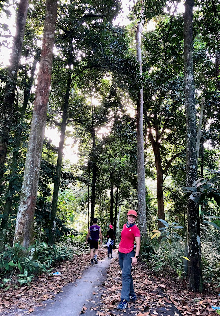
| Trail Condition |
 |
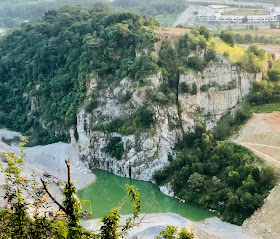
| Seremban Green Lake |
 |
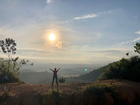
| Open AreaView Point |
 |
| Lake View 2 |
 |
| Asli Hut |
 |
| Kampung Sebir |
 |
| Construction Area |
 |
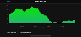
| Seremban Green Lake Trail Profile |


Mchiker saw u several time at kepayang hill last 3 years. I dont know its you. Hehe
ReplyDelete. By the way nice to meet u here.. can u share me this gpx thru my email hike4dx[at]gmail . C o m tq
Already emailed to you.
DeleteHi. Can share gpx file?
ReplyDeleteI have uploaded the GPX File in wikiloc or you can email to me mailbox.mchiker@gmail.com if you can't find it.
DeleteHi. Good day. I have sent email to you. Can you share the GPX file.. Thanks
ReplyDeleteSent to you on that day
DeleteHi sir, can u send me a gpx?
ReplyDeleteashraf.inno@gmail.com
Hi sir... I knew you from your previous blog of hiking to Gunung Besar Hantu. If you don't mind could you please share the starting point from KG. Sebir to Bkt. Bal. Because I'm quite afraid to use the normal track from that housing area since it permanently closed. This is my email. Thank you in advance. unsangkarabletul@yahoo.com
ReplyDeleteHi, good day. Thanks for the info, would like to know is the trail are able to be hiked by 4 yrs old boy?
ReplyDelete