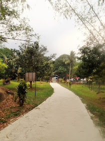
The Trek
- Height : 4898 feet ( 1498 meter) N3.26659 E101.90023
- Location : Hulu Langat, Lembah Pangsun (Selangor)
- Usually it takes 10~14 hours
- Distance : about 30+ KM
Getting there
- From Cheras-Kajang highway, take the first turning to the left after passing the toll.
- Go straight till you reach Batu 9 police station where you need to take a left turning.
- Go straight till the end of the road.
- The trail head (N3.21639 E101.88369)
Facilities and Fees
- Toilet and Bathroom :Yes
- Parking : Parking Area
- Guide : No
- Permit Fee : RM 5.00 (Apply in advance)
- JPSM Permit Information
- JPSM Contact Information
Exploring Reverse Trans Nuang
(Pangsun ~ Nuang Summit - Chemperoh Waterfall - Nuang Summit - Pangsun)
March, 19 2016
Gunung Nuang is always a good training ground before any
camping or long day hike activity. It located in center region of Malaysia
which you could travel and hike without overnight arrangement. From Pangsun car
park to Nuang summit covered 11+ KM distance with 1500+ meter elevations
gain/loss.
We decided to take a try for the Reverse Trans Nuang till
Chemperoh Waterfall this round as this is our first attempt for it and couldn't
expect how long it will takes, expecting easily 13~14 hours. Our schedule plan
start at 6:00 a.m. by the time reach back Never Ending Road at 7:00 p.m. still
safe for us not hiking dark in the jungle.
Stage 1 : Pangsun Car Park to Nuang Summit - Unexpected
smooth, personal best record (3 h 44 m)
Stage 2: Nuang Summit to Chemperoh Waterfall - Slow
and steady (1 h 21m)
Stage 3: Chemperoh Watefall to Nuang Summit - Feel tired and
sleepy (2 h 02m)
Stage 4: Nuang Summit to Pangsun Car
Park - "Never do it again" (3 h 29 m)
06:41 Start Hike
07:42 End of Never Ending Road
08:04 Camp Lolo
08:58 Camp Pacat (Rest for 10 minutes)
09:57 False Peak
10:25 Round One - Nuang Summit (Rest for 14 minutes)
10:39 Descent to Chemperoh Waterfall
11:01 Junction to Bukit Repin
12:00 Chemperoh Waterfall (Rest for 37 minutes)
12:37 Ascent back to Nuang Summit
14:00 Junction to Bukit Repin
14:39 Round Two - Nuang Summit (Rest for 31 minutes)
15:10 Descent to Pangsun Car Park
15:39 False Peak
16:24 Camp Pacat (Rest for 8 minutes)
17:24 Camp Lolo
18:39 Car Park
Completed 30+ KM within 12 hours, ahead our schedule time.
 |
| Start in the dark - 6:41 a.m. |
 |
| End of "Never Ending Road" |
 |
| Camp Lolo |
 |
| Camp Pacat |
 |
| False Peak |
 |
| Summit! |
 |
| Round One |
 |
| Junction To Bukit Repin |
 |
| Finally...Reach Chemperoh Waterfall |
 |
| Hiking back to Nuang Summit |
 |
| All the way up! |
 |
| Happy to See this Rock...Summit just nearby |
 |
| Round Two |
 |
| Start Descent |
 |
| False Peak |
 |
| Camp Pacat |
 |
| Camp Lolo |
 |
| Finally... |
 |
| Mission Completed |
 |
| Reverse Trans Nuang Trail Map GPS Trail Log Download |
 |
| Reverse Trans Nuang Trail Profile |


My friend and I had planned to do the traverse and this is good info and an inspiration!
ReplyDeleteThanks!
Wah
Hi bro mcHiker can share whatwis tge softsoft usedfiru the gps tratrack trail and comparisons?
ReplyDeleteHi, I'm using Garmin BaseCamp software for viewing and updating my GPS log. As for comparisons for multiple trail. you may use online tools www.gpsvisualizer.com/elevation
DeleteHi Mr McHiker, may I know what series of garmin watch are you using ?
ReplyDeleteHaha...I'm still using my Garmin Fenix 3 to log my trail info.
DeleteOh nice. I was thinking about getting a Garmin Instinct. Do you have any advice on that Mr. McHiker?
DeleteHi Ram,
DeleteFor my personal point of view, if you are looking for a sport watch for:-
1. Log your activities, monitor current GPS Information/Heart Rate (Any brand but recommended Huawei GT2, COROS APEX below RM 1.2K)
2. Log your GPS location and exportable the log file (Garmin. I'm not too sure whether Garmin Instinct comes with this feature or not)
3. Import GPS log (Garmin. I'm not too sure whether Garmin Instinct comes with this feature or not)
CAN I ASK SOME THING ABOUT HIKING...WE MEET IN GUNUNG NUANG LAST MTH MAY2022...HAVE I HAVE YOUR WHATAPP ...IN ngsengfoo@yahoo.com
ReplyDeletei have many about hiking want to ask.....tq
ReplyDelete