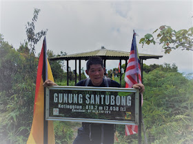
The Trek
- Height : 2657feet ( 810 meter) N1.73163, E110.33243
- Location : Kuching (Sarawak)
- Usually it takes 2.5 ~ 4 hours to reach summit
- Distance : about 4.2 KM (One way)
Getting there
- About 30 minutes (30 KM) from Kuching town
- Follow Jalan Sultan Tengah towards Santubong National Park
- The trail head start from Santubong National Park Headquarter (N1.74398, E110.31668)
Facilities and Fees
- Toilet and Bathroom : Yes
- Parking : Roadside
- Guide : No
- Permit : No but need to register
GPX in Google Map
Gunung Santubong Trail Map
Exploring Mount Santubong
November, 19 2017
Mount Santubong, the highest mountain in Kuching town with the high of 810 meter (2657 feet) located 30 KM away from Kuching town.
You need to register yourself at the office and follow the red color marker lead you all the way. The mountain is not that high but it very challenging and steep with rope and ladder climb.
Stage 1: Headquarter - F5 (Waterfall) - F7 (View Point)
About 2.7 KM jungle walk but not much ascent
Stage 2: F7 (View Point) - Summit
About 1.5 KM steep ascent and multiple ladder climbs
0840 Start
0852 Y Junction
0905 F2
0920 F5 Waterfall
0933 F6
0940 F7 View Point
1000 F8 False Peak
1013 False Peak
1040 False Peak
1107 Summit
1137 Descent
1155 False Peak
1222 F8
1242 F7
1257 Waterfall
1344 End
 |
| Y Junction |
 |
| F5 - Waterfall |
 |
| F7 - View Point |
 |
| F8 - False Peak |
 |
| F8 - False Peak |
 |
| F9 - Ladder Section |
 |
| False Peak |
 |
| False Peak |
 |
| Mount Santubong Trail Map |
 |
| Mount Santubong Trail Profile |


Very details log of your climb, now the rope ladders had been replaced to aluminium ladder, safer but that as challenging as before.
ReplyDelete